
I was curious about the effect of recent heavy rain on the river. I decided to go and have a look. The North River at Billingshurst was very high, it was over the banks and into the surrounding fields. The fields on both sides of the bridge looked like fifty acre lakes. The water was coloured by the mixture of clay and greensand it flows through. A milky-caramel colour, not very attractive. As I drove towards Petworth the heavy rain turned to sleet.
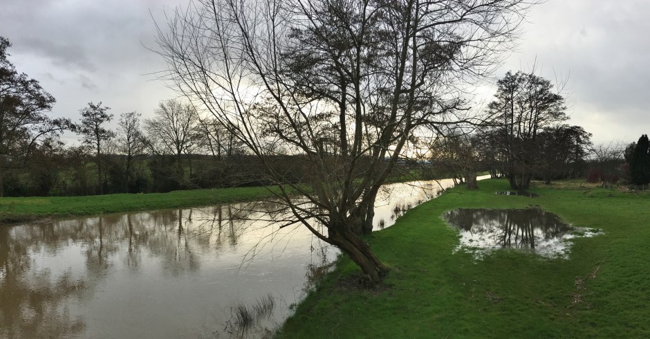
I stopped at Rotherbridge where the river had remained within it’s banks. Between 1791 and 1794 eleven miles of the river between Midhurst and Stopham were made navigable. Barges brought coal for the iron works and took local stone away. Consequently, the river there is deeper and straighter than nature intended.
The Rother is an old, lowland river with a wide floodplain and extensive water meadows. The entire river valley has been designated as a Site of Nature Conservation Importance (SNCI). The winter floods warm the soil and deposit silt which enriches the pastures. That improves the summer grazing and the biodiversity of the fields. However, the floods also wash ammonium nitrate fertilizer and silt into the river.
I stood on the bridge wondering how the trout had faired during the mild and dry winter. There should be a few sheltering in the roots of the Willow and Alder trees beside the bridge. I made a mental note to start my season on the river at Rotherbridge.
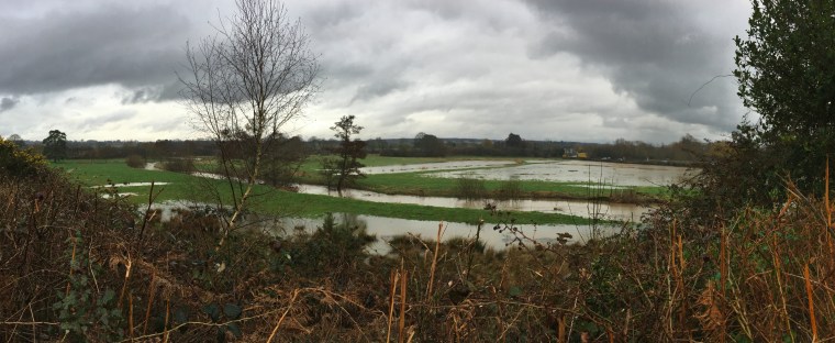
I went downstream beyond Kilsham Farm and looked across the fields towards The Badgers. The water meadows were flooded but I could clearly see the course of the river. There was no danger of the pub flooding, unlike December 2013 when the top of the bar was underwater.
Unfortunately, I had to attend a meeting in Petworth and a visit to The Badgers was out of the question. I consoled myself with a nice bottle of Fleurie from the wine merchants in the town.

